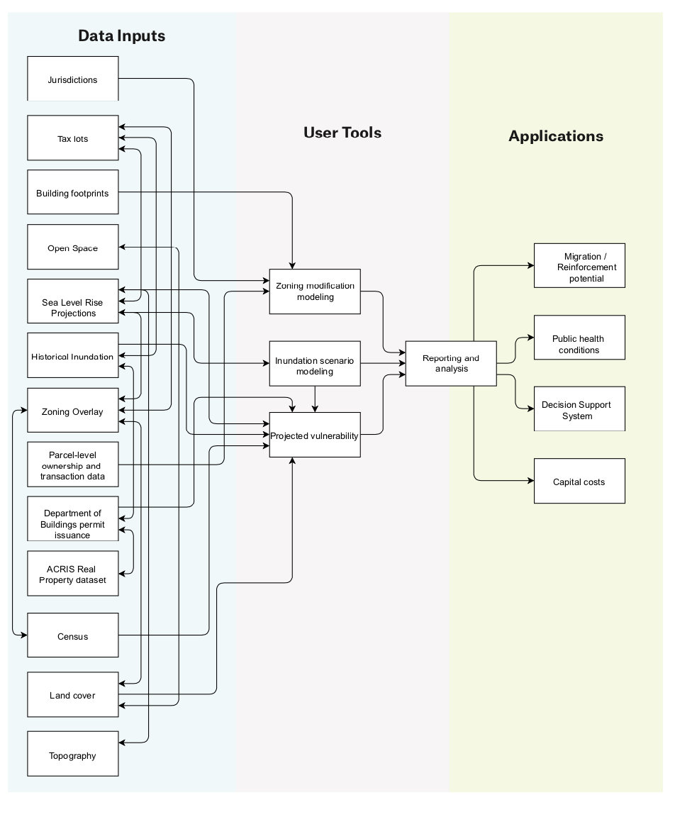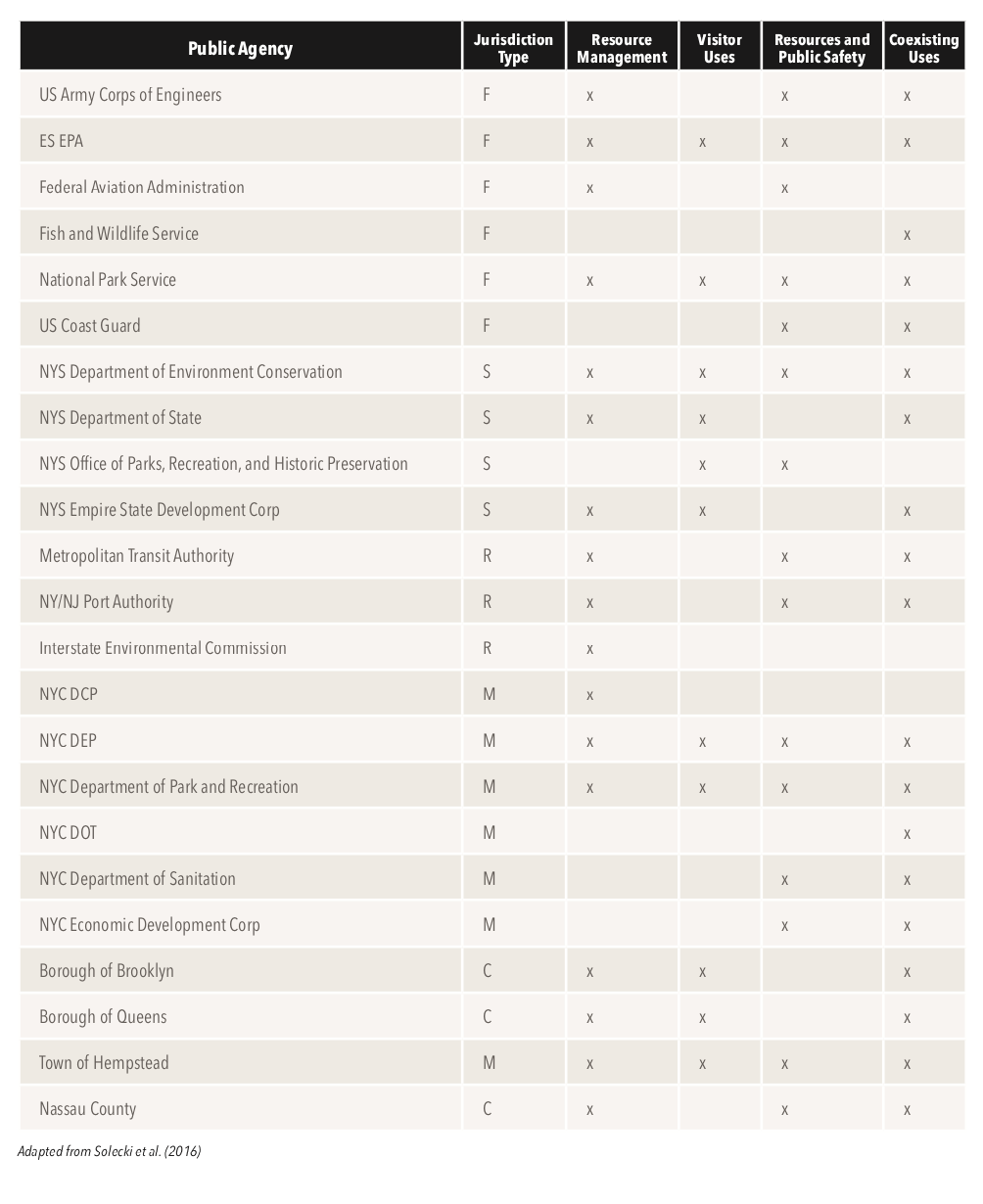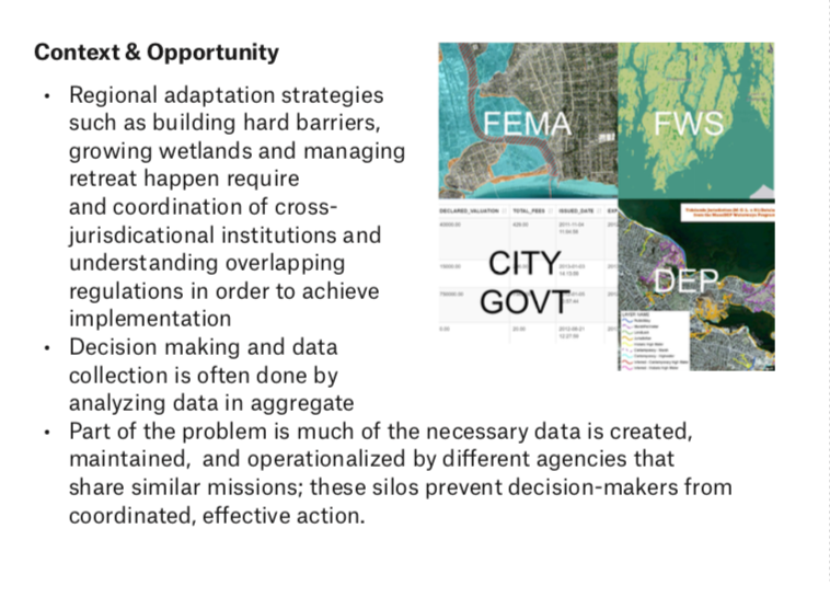
Coastal communities around the world face an imminent and accelerating threat from rising seas and more frequent extreme storms. Coordinated, regional adaptation strategies such as building hard barriers, growing wetlands and managing retreat are needed to adapt effectively and expediently. However, coastal areas often have overlapping policies dictated by various regulatory agencies, posing planners with decision-making and implementation barriers. Our project combines municipal and state datasets including zoning codes, land use, environmental restrictions and projected storm surges into a spatially enabled relational database to determine restrictions at a parcel-by- parcel level. Virtual modification enables users to simulate 3D scenarios such as maximum build out under future conditions or development implications to building a seawall. This research proposes a method to visualize overlapping to visualize and modify overlapping land use, zoning and regulation that reveals the impact of new adaptation policy on the form and function of coastal cities.
Received $5000 from MIT's Sandbox Innovation Grant to complete market and feasibility research. Worked in collaboration with Scott Gilman and Mario Giampieri.
Won the 2019 APA Student Poster Award in Technology and Planning.